‘What river?’: How Mumbai’s neglected Mithi punishes those who live on its banks
Infrastructural changes and everyday realities like the dumping of waste have made life inhospitable for the city’s poorest


Editor's Note: The last two decades have been witness to the rapid and devastating march of unchecked urbanisation and climate change in India’s cities. Among the first victims of this change is freshwater and access to it—from rivers which sustained local ecosystems, to lakes and groundwater which quenched the thirst of residents. In this series, the Good Food Movement examines the everyday realities of neglect and pollution. It documents the vanishing and revival of water bodies, and community action that made a difference.
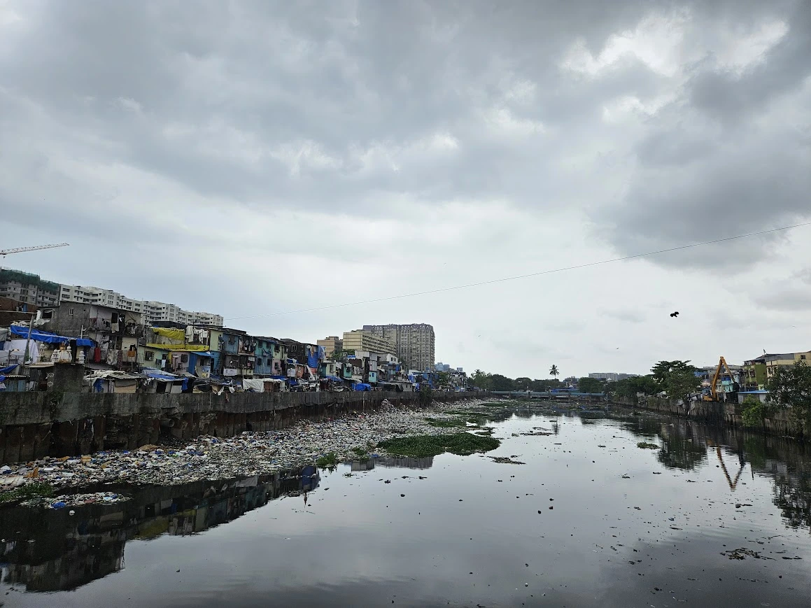
On a bank of Mumbai’s Mithi—a serpentine, nearly 18 kilometre-long river—a group of children gather to play at Valmiki Nagar in the Bandra East suburb. One may imagine a childhood by a riverbank to be full of frolicking in its waters, but this is the harsh truth: the children of Valmiki Nagar spend most of their early years amid piles of garbage. A few years ago, a mound of waste near the bank was cleared, which has now become a playing area. Scattered across the ground are pieces of crumpled plastic, torn fabric, and broken debris—little dots splattered on the landscape on a risky, steep slope that drops sharply towards the river.
What can a river, neglected and polluted for decades, take away from human life?
The Mithi has two identities: at once, it is a rain-fed river as well as a stormwater drain.
The Mithi, whose name incidentally—and ironically—translates to “sweet” in Hindi, originates from the Vihar Lake outfall, and also receives water from the Powai Lake further downstream (its upstream catchment area has three lakes—Tulsi, Vihar and Powai). Across its stretch, it is not uncommon to spot people throwing garbage, small-scale vendors dumping scrap materials, and industrial units draining effluents into the river. The Mithi is also choked by untreated sewage and stormwater—and this is not just anecdotal of a particular neighbourhood it snakes through. According to the 2022-23 Water Quality Index, the river exhibits a concerning water quality status with an annual average WQI recorded as 35, indicating it is “Heavily Polluted”. A good, healthy river will have a WQI of at least 75, and excellent health will reflect in a score of above 90.
For over a decade, Talat Jahan, 40, has been residing at one of its banks in Sant Dnyaneshwar Nagar, opposite the Bandra-Kurla Complex (BKC) business hub. She has long given up on the idea of a better future for her neighbourhood. “Everytime my 17-year-old daughter comes back from her hostel, I send her across the river to our other flat as the living conditions here are intolerable for her. Residents get offended and argue with you if you ask them not to throw garbage into the river,” she shares.
Why are the residents along Mithi’s banks left to this fate? The answer is revealed in a series of events that led to this consistent neglect of the river as well as the dwellers living along its shores—only made worse by staggered development, massive embezzlement and an abject ignorance of the city’s topography.
A brief history, from colonial times to 2005
From BKC to the slums of Dharavi, if one were to ask for directions to the Mithi river, they’d perhaps be greeted with puzzled stares and a curious question: “River? What river?” To the locals who have built a life alongside the river, the water body is known as a nallah, a word used to refer to a drain—usually a sewage drain. “Arre, wo toh nallah hai,” they will tell you.
“It is a river for all biological and scientific reasons, but in the Brihanmumbai Municipal Corporation’s (BMC) records, it is referred to as a stormwater drain. For the BMC, the river is a ‘Pavsali nallah’ in Marathi, which means ‘seasonal water drain’,” explains Stalin D., director of the NGO Vanashakti, a Mumbai-based environmental NGO that has been working to conserve mangroves, wetlands, rivers and coastal belts for nearly two decades now.
The Mithi has two identities: at once, it is a rain-fed river as well as a stormwater drain. Originally, it was only a river with water flowing solely in the monsoon season. It was a part of the city’s water supply chain, used as a transport system, and importantly, the estuarine region of the river fed and supported the local fishing communities. It was large, clean, deep. But it was in the way of a growing city.
In the late 18th century, when Mumbai was a collection of seven islands, a major land reclamation project began; under the East India Company, the erstwhile Bombay was to become one, joined city. Land was reclaimed from the water bodies flowing in and around the city, and all seven islands were united by roughly 1838. This put into motion a series of land reclamation projects that would, again and again, sew Mumbai’s lands together.
Alongside reclamation, encroachments—slums and unauthorised construction—significantly narrowed the river’s flow path, reducing its natural capacity to carry floodwaters and causing severe bottlenecks.
The Mithi river has always been important to Mumbai. It runs through some of the densest areas of the city, and is able to drain water from multiple suburbs like Powai, Andheri, Kurla, and Bandra when it rains. It also provides the most direct route to carry the excess runoff to the Arabian Sea, where it eventually drains off. And Mumbai’s particular topography, which affords it excessive rainfall in the monsoon season, presented the need to think carefully and urgently about flood planning. And so, as Mumbai underwent rapid urbanisation, the Mithi was “trained” as a stormwater drain.
Large-scale land reclamation drastically reduced the river's original 800ha, as reported in 1930, to 400ha by 1973. In 1978, the Mumbai Metropolitan Regional Development Authority (MMRDA) reclaimed 370 hectares of land to create the Bandra Kurla Complex (BKC), of which 220 hectares were borrowed from the Mithi estuarine reach. Additionally, the construction of Mumbai’s International Airport and all related work from 1977 to 2004 also reclaimed swathes of land from the Mithi, destroying surrounding mudflats—essentially crumbling an entire ecosystem that traps toxins and houses biodiversity as well as nutrients crucial to the health of the river. The constant work at the airport forced the river to deviate unnaturally and rearranged its erstwhile linear flow.
Also read: The intertwined fate of Navi Mumbai’s Kolis and the Kasardi river
Choked by waste and urban sprawl
These infrastructural changes were not without consequence: Since Mumbai is an island city, several parts are at a low altitude above mean sea level (MSL). When high intensity rainfall coincides with high tide, flooding takes place in low-lying areas. That was the case of the sudden deluge on 26 July, 2005. The suburban part of the city experienced unprecedented, heavy showers with a record of 944 mm of rainfall in 24 hours—and the highest rainfall intensity of 190.3 mm in one hour between 15.30 pm to 16.30 pm. This coincided with the highest tide of 4.48 m.
The Mithi—choked, thinned and heavy—extracted its revenge by throwing up caught rainwater into the city, leading to a devastating flood in a form that was much worse than it otherwise could have been.
Alongside reclamation, encroachments—slums and unauthorised construction—significantly narrowed the river’s flow path, reducing its natural capacity to carry floodwaters and causing severe bottlenecks. “The river’s training was not really focused on the river itself, but on creating assets, with what remained taking the shape of the river,” says urbanist Gautam Kirtane.
To be neighbours with a neglected river
Presently, as the water from the Vihar lake flows down, it passes through Filterpada, a notified slum and the first immediate settlement on the river. Zoya, a 10-year-old who lives in Filterpada, shares that she battles swarms of mosquitoes every night, relying on repellants like coils.
When the water from both the Vihar and Powai merges, the river threads through the neighbourhoods of Morarji Nagar and Jai Bhim Nagar in Powai. As one steps down from the main road to enter into the slums of Jai Bhim Nagar, the river emerges as an open-mouthed dumping site for household waste. In the area, a visibly gigantic freshwater pipeline passes over the river, through the two localities. This risky pipeline is often used by children and adults to walk over and cross the river in a hurry.
Ahsan Akhtar Sayyed, over 70 years old, has lived in Powai's Jai Bhim Nagar for over two decades. He is also the president of the Aadarsh Rahiwashi Welfare Committee, a group formed to resolve the issues of Mumbaikars living in the area. “Earlier, though the water was polluted, as it included wastewater from households and the runoff from cleaning filter tanks, the Mithi was never stagnant. Today, aside from the monsoon season, the river is inert, which leads to waste getting accumulated and rotting for several months—sometimes years,” says Sayyed. In this neighbourhood, the river is covered with blankets of hyacinth and other waste.
A few months before every monsoon, a strange routine unfolds: a bulldozer collects the waste rotting in the river.
Barring one placed in front of Sayyed’s house, there are no dustbins in the riverfront lane. Neither is there any door-to-door collection of waste here, Sayyed informs; even this lone bin was provided by the current MLA of Andheri East, Murji Patel. Residents are asked to dispose of garbage in one dumpster kept at a distance; with access so curbed, residents are left with no choice. As a result, an unbearably foul smell emanates from the bank.
“Yeh garib basti hai (This is a slum),” says Sayyed, “People here leave early in the morning and return home late, after work. It is difficult for them to worry about environmental issues when they are finding it difficult to make ends meet.”
A few months before every monsoon, a strange routine unfolds: a bulldozer collects the waste rotting in the river, Sayyed shares. “But since a dumping truck can’t enter inside the narrow lanes of this neighbourhood, the garbage is levelled back into the river.” Stalin throws light on this inexplicable phenomenon: the waste is levelled inside the river when heavy rains are expected so that it can be carried further downstream as the river flows. The waste then gets collected in the mangrove near the BKC estuary area, polluting the ecosystem heavily.
Notably, the Mithi has been consistently included in Priority I of Mumbai’s polluted river stretches, primarily due to Biochemical Oxygen Demand (BOD) values exceeding 30 mg/l. The average BOD of Mithi in 2022-23 was 37.3 mg/l, and the maximum was 82 mg/l.
Retaining walls are constructed along riverbanks to secure the edges between two ground surfaces of different elevations. However, in the case of Mithi river, these were constructed to train the river’s course for flood control, after the 2005 floods. Jal Biradari, a community dedicated to the protection and revival of rivers, and the Vanashakti NGO challenged the Coastal Regulation Zone (CRZ) clearance granted for constructing retaining walls, which impeded water flow to mangroves. In May 2016, the National Green Tribunal imposed a Rs 25 lakh fine on the MMRDA as environmental compensation for violating CRZ norms by constructing retaining walls.
“Years ago, in 1995, this place felt like our village. The river was dirty and had waste dumped on the sides, but it was visibly clean in the centre. There were no retaining walls and the water was 15-20 feet deep. People would bathe in it and wash their clothes at the banks,” Sayyed says, recalling the “acche din” of the river’s past.
Also read: The Chitlapakkam Rising story: How a Chennai community saved a lake
An unchanging fate
For Sant Dnyaneshwar Nagar’s residents in BKC, it is a nightmare to bear the consequences of all these years of neglect. One is greeted by heaps of solid waste on the entrance road of this area; not only can you find residents and shopkeepers throwing waste nonchalantly into the river, but also children competing against each other–aiming for the farthest shot. The river is heavily contaminated with plastic bags, scrap materials, food waste, metal, alcohol bottles and thermocol waste. You may even happen upon an unbearable sight for any nature lover: birds like sparrows, crows and egrets searching through waste to find food for themselves.
As is the case in Powai’s Jai Bhim Nagar, there is no dumpster in sight at the riverfront lane. In fact, in the low-lying area of Valmiki Nagar, it won’t be surprising to find an empty dustbin afloat at the bank’s edge, surrounded by trash.
"Previously, we tried to install dustbins in Sant Dnyaneshwar Nagar, but delinquents either burnt them or sold them to scrap dealers for quick cash," says Lubna Shaikh, a social worker. During the scorching heat of the summer, locals have no option but to take calculated breaths amid the stench of rotting waste that persists for months, even years, as water in the river remains stagnant. “This is a densely populated area where malaria, dengue and typhoid are some of the most common diseases,” Shaikh adds.
Talat Jahan, who has a family of five and runs a paan shop, says, “Earlier, I used to confront people, but now I have resigned and accepted that I will have to live in this condition. I don’t have time to get into fights or arguments—I have a family to run and look out for. People in the neighbourhood have accepted this lifestyle.” She has a rental stay near Kalyan on the outskirts of Mumbai where a door-to-door garbage collection service can be opted for. But owing to her livelihood and her husband’s illness, she is bound to reside in Sant Dnyaneshwar Nagar. Mumbaikars like her question the unfairness of living in a city where one neighbourhood has access to garbage collection services, but the other is entirely deprived of them.
During the scorching heat of the summer, locals have no option but to take calculated breaths amid the stench of rotting waste that persists for months, even years, as water in the river remains stagnant.
The typical pre-monsoon sight of an excavator crane in Bharat Nagar removing the waste and hyacinth from the river—leaving a trail of charcoal-coloured leachate behind on the road—is a stark reminder of how year-long neglect takes a physical form. This year, as of June, this waste collection drive was not undertaken.

The nearby neighbourhoods of Maharashtra Nagar and Valmiki Nagar (across the river) bear the brunt of Mumbai’s heavy rainfall. “The residents have to pay a heavy price as there is an absence of retaining walls in these regions since 2017, when exceptionally strong rainfall led to collapse of the previous wall,” shares Shaikh.
The retaining walls serve more than one purpose. Urbanist Gautam Kirtane sheds light on a sociological phenomenon—“splintering urbanism”—that emerges from geographical division: about how the city's local train lines shape its wealth brackets. For example, the areas to the west of the Western Line include suburbs like Bandra, Santacruz, and Khar that are far more affluent than the eastern side of the same line: Dharavi, Bandra East, and Kurla.
Such a pattern can also be observed along the course of the Mithi river. "The Mithi is the most in-your-face example of the distinction between slum and non-slum areas. It actually divides the city into administrative divisions. All that is on the east of the river are the eastern suburbs and on the west, the western suburbs. Much of the administrative boundary is also defined by this wealth differentiation. So, from a sociological perspective, these retaining walls are the great wall of Mumbai," says Kirtane.
The urbanist has observed a difference in waste management policies for slums and non-slums in Mumbai. “In the slums, a project called the Swachh Mumbai Prabodhan Abhiyan (SMPA) is conducted on a voluntary basis. But ideally, waste collection is supposed to be a mandatory function of urban local bodies,” he explains, arguing that this unequal treatment stems from the city's perception of slums. “There's a classist and casteist undertone to this reality,” he explains.
While residents have adapted to the river’s polluted state, their survival costs them multifold—in health, safety, and dignity. The authorities’ piecemeal efforts across desilting, retaining walls, and offering unfulfilled promises have failed to address the root causes of the river’s degradation. “The Mithi comes under the storm water management department of the BMC. Stormwater is meant to carry only rainwater, the garbage in the rainwater is to be removed by the solid waste department. The solid waste department puts its hands up when tasked with removing waste from the storm water area,” says Stalin, underscoring how the responsibility of ensuring their well-being, safety and health falls squarely on the shoulders of riverbank residents, abandoned by city authorities and urban planners.
Also read: In Gurugram’s rise, a cautionary tale about satellite cities and groundwater
Edited by Neerja Deodhar and Anushka Mukherjee
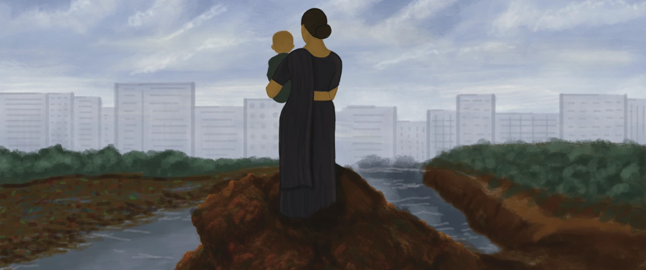
Illustration by: Khyati K
Produced by Nevin Thomas and Neerja Deodhar
{{quiz}}


Explore other topics
References